

Iceland Highlands
Europe's last true wilderness — a roadless interior of rhyolite mountains, black-sand deserts, glaciers and volcanoes, open only in summer and reached by rugged F-roads.
Area
~40,000 km²
Highest Peak
Bárðarbunga 2,009 m
Season
Late Jun – early Sep
4WD Required
Yes (F-roads)
F-Roads
Unbridged rivers
Summer Temp
7–13 °C
Introduction
What Are the Iceland Highlands?
Miðhálendið — the uninhabited heart of Iceland.
The Highlands cover the vast, empty interior that most visitors only glimpse from the ring of the coast. No one lives here. There are no towns, no shops and no paved roads — only gravel F-roads, unbridged rivers and some of the most otherworldly landscapes on the planet, making this one of Europe's last true wilderness areas.
It is a place of superlatives: the rainbow rhyolite mountains and hot bathing river of Landmannalaugar; the green oasis of Þórsmörk between three glaciers; the remote Askja caldera with its warm crater lake; the geothermal valleys of Kerlingarfjöll and Hveravellir; and the endless black deserts of Sprengisandur and Kjölur. The Laugavegur Trail threads through the south of it.
Access is strictly seasonal. The interior opens only when the snow clears — roughly late June to early September — and every route is an F-road that legally requires a four-wheel-drive vehicle. Many roads involve river crossings with no bridges, which is why the right vehicle, preparation and caution matter so much. With no fuel, shops or reliable phone signal for hours in any direction, the Highlands reward the prepared and humble the careless.
16+
Attractions
2,009 m
Highest Peak
Jul–Sep
Road Season
Yes
4WD Required
Many
River Crossings
1
National Park
10+
Volcanoes
6+
Hot Springs
Explore
Interactive Highlands Map
22 attractions and hot springs mapped — filter by category and tap a pin.
Destinations
Explore the Highlands
The interior's ten defining places — with distances, difficulty and best season.
 IntermediateF208 / F225
Landmannalaugar
Vivid rhyolite mountains, a natural hot bathing river and the start of the Laugavegur trail.
Distance
180 km
Drive
3–4 h
Season
Jul–Sep
 AdvancedF249
Þórsmörk
A lush valley cradled between three glaciers — a hiking paradise reached by river-heavy roads.
Distance
150 km
Drive
Super Jeep / bus
Season
Jun–Sep
 AdvancedF88 / F905
Askja
A remote caldera at 1,100 m with the warm, milky-blue Víti crater lake you can bathe in.
Distance
Northeast interior
Drive
Full-day / tour
Season
Jul–early Sep
 IntermediateF35 (Kjölur)
Kerlingarfjöll
Steaming geothermal valleys among colourful rhyolite peaks, with a mountain resort base.
Distance
Central Highlands
Drive
3–4 h
Season
Jul–Sep
 Easy–IntermediateF35 (Kjölur)
Hveravellir
A geothermal oasis of fumaroles and hot springs midway across the Kjölur route.
Distance
Central Highlands
Drive
3–4 h
Season
Jul–Sep
 AdvancedF206
Lakagígar
The 130-crater row of the catastrophic 1783 Laki eruption, cloaked in deep green moss.
Distance
South Highlands
Drive
Full-day / tour
Season
Jul–Sep
 AdvancedF225 / F26
Hekla
Iceland's most active volcano — 'the Gateway to Hell' of medieval legend.
Distance
South Highlands
Drive
2.5–3 h
Season
Jul–Sep
 IntermediateF208 / F225
Fjallabak
The wider nature reserve around Landmannalaugar — obsidian fields, lakes and painted mountains.
Distance
South Highlands
Drive
3–4 h
Season
Jul–Sep
 AdvancedF26
Sprengisandur
The classic black-desert crossing between the northern and southern glaciers.
Distance
N–S traverse
Drive
Full-day
Season
Jul–Aug
 IntermediateF35
Kjölur
The easier interior traverse between Langjökull and Hofsjökull — no major river fords.
Distance
N–S traverse
Drive
5–6 h
Season
Jul–Sep
From Our Library
Featured Highland Attractions
Loaded live from our content library.
Blahnukur Summit Trail
Colorful rhyolite mountain hike with sweeping highland views.


Dreki Campsite (Askja)
Dreki is the base camp for excursions to Askja — one of Iceland's most dramatic volcanic calderas. Here you will find Víti — a warm crater lake you can swim in — and Öskjuvatn — Iceland's deepest lake. The campsite is in the middle of the highlands and is accessible only by 4x4 vehicles on F-roads.
Fjallabak Nature Reserve Trail
Remote highland trail through volcanic landscapes and rivers.

Friðmundará
Friðmundará: a powerful tiered waterfall cascading through a rugged canyon, steeped in ancient Icelandic folklore.
Hveradalir Kerlingarfjoll Trail
Trail through colorful geothermal valleys in Kerlingarfjoll.
Hveravellir Campsite
A remote Highland campsite beside geothermal hot springs between Langjökull and Hofsjökull glaciers.

Hvítárvatn Campsite
A remote Highland campsite beside Hvítárvatn lake with views toward Langjökull glacier along the Kjölur Route.
Through the Lens
Highlands Photo Gallery
Tap any image for a fullscreen view.
Guided Experiences
Tours & Day Trips in Iceland
Golden Circle, Northern Lights hunts, whale watching, glacier hikes, lava cave tours and more. Book with free cancellation — confirmed instantly.
Plan
Suggested Itineraries
Ready-made plans — build them out in the Trip Planner.
Landmannalaugar Day Trip
- Super Jeep or bus in
- Rhyolite mountain hikes
- Bathe in the hot river
- Return by evening
Þórsmörk & Landmannalaugar
- Day 1: Landmannalaugar hikes & hot river
- Day 2: Þórsmörk valley hiking between the glaciers
Laugavegur Trek
- Landmannalaugar → Hrafntinnusker
- → Álftavatn
- → Emstrur
- → Þórsmörk
On Foot
Highland Hiking Trails
From the world-famous Laugavegur to short geothermal loops.
Laugavegur Trail
ChallengingLandmannalaugar to Þórsmörk through rhyolite hills, glaciers and gorges — Iceland's most famous trek.
Distance
55 km
Ascent
~1,100 m
Time
2–4 days
Season
Jul–Sep
Fimmvörðuháls
ChallengingÞórsmörk to Skógar between Eyjafjallajökull and Mýrdalsjökull, past the 2010 eruption craters.
Distance
25 km
Ascent
~1,000 m
Time
1–2 days
Season
Jul–Sep
Hveradalir (Kerlingarfjöll)
ModerateLoop trails through a steaming geothermal valley of coloured mountains and bubbling springs.
Distance
3–10 km
Ascent
~400 m
Time
2–4 h
Season
Jul–Sep
Askja & Víti
ModerateFrom Vikraborgir across the lava to the Víti crater and Öskjuvatn caldera lake.
Distance
5 km
Ascent
~150 m
Time
1–2 h
Season
Jul–Sep
Under Canvas
Highland Campsites
Designated sites beside the mountain huts — the only places to camp inside.
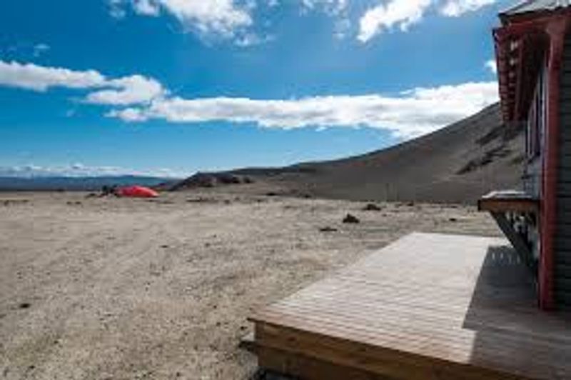
Dreki Campsite (Askja)
Dreki is the base camp for excursions to Askja — one of Iceland's most dramatic volcanic calderas. Here you will find Víti — a warm crater lake you can swim in — and Öskjuvatn — Iceland's deepest lake. The campsite is in the middle of the highlands and is accessible only by 4x4 vehicles on F-roads.
Explore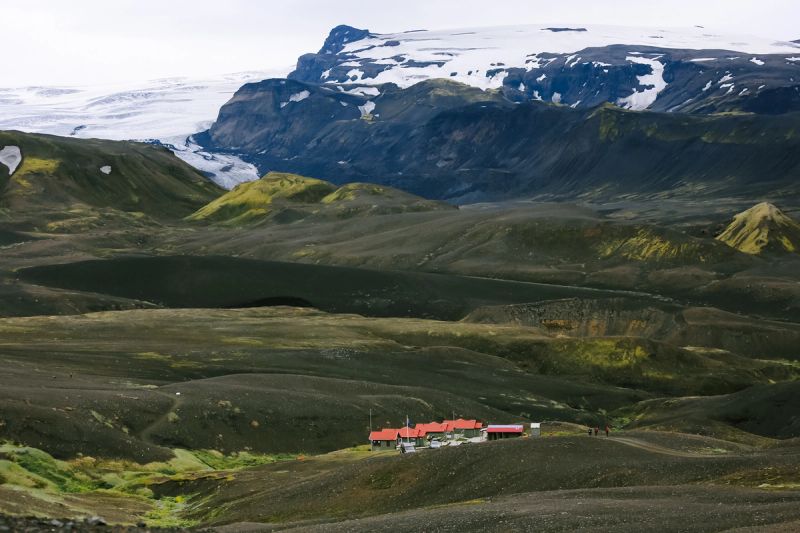
Emstrur – Botnar Tjaldsvæði (Laugavegur)
Emstrur (Botnar) is the third rest stop on the Laugavegur hiking trail, between Álftavatn and Þórsmörk. This is one of the most remote and wild campsites on the route, deep in the highlands between Mýrdalsjökull and Entujökull glaciers. Distant views of Katla volcano and unforgettable glacier scenery.
Explore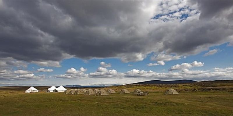
Hveravellir Campsite
A remote Highland campsite beside geothermal hot springs between Langjökull and Hofsjökull glaciers.
Explore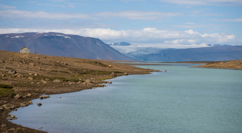
Hvítárvatn Campsite
A remote Highland campsite beside Hvítárvatn lake with views toward Langjökull glacier along the Kjölur Route.
Explore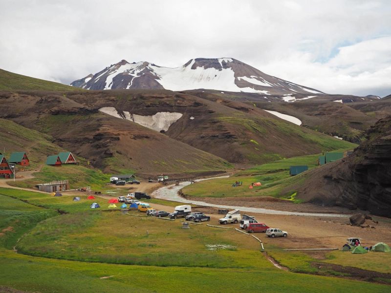
Kerlingarfjöll Tjaldsvæði
A remote Highland campsite surrounded by colorful rhyolite mountains and geothermal valleys along the Kjölur Route.
Explore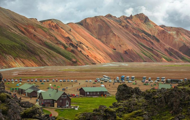
Landmannalaugar Campsite
A remote Highland campsite in Landmannalaugar surrounded by colorful rhyolite mountains and natural geothermal hot springs.
ExploreFind Hotels in Iceland
From cozy Reykjavík guesthouses to remote Highland lodges — thousands of properties with free cancellation and best price guarantee.
Season by Season
When to Visit the Highlands
The interior has essentially one season — here's how the year compares.
🌱Spring
Apr–Jun- Roads
- Mostly closed — snowmelt
- Weather
- Cold, unstable
- Camping
- Not yet open
- Access
- Very limited
- Safety
- High meltwater in rivers
☀️Summer
Jul–early Sep- Roads
- F-roads open
- Weather
- 7–13 °C, long light
- Camping
- Huts & sites open
- Access
- Best — 4x4 or tour
- Safety
- Check rivers & weather
🍂Autumn
mid Sep–Oct- Roads
- Closing with snow
- Weather
- Cold, first snows
- Camping
- Sites closing
- Access
- Unreliable
- Safety
- Sudden closures
❄️Winter
Nov–Mar- Roads
- Closed to self-drive
- Weather
- Sub-zero, storms
- Camping
- Closed
- Access
- Guided tours only
- Safety
- Extreme — tours only
Read This First
Highlands Safety
The Highlands are stunning but unforgiving. These are non-negotiables before you head inside.
Emergency: 112
Dial 112 anywhere in Iceland. Download the 112 Iceland app — it can send your GPS location to rescue teams.
Road conditions
Check road.is before and during your drive for live F-road status, and umferdin.is for closures.
River crossings
Never cross a river blind. Assess depth and current on foot first, cross slowly in low gear, and turn back if unsure. Rental insurance never covers water damage.
Fuel planning
There is no fuel inside the Highlands. Fill up in the last town (Hella, Hvolsvöllur, Reykholt, Varmahlíð) and carry a reserve.
No phone coverage
Mobile signal is absent across much of the interior. Carry a satellite communicator or a PLB for emergencies.
Offline maps
Download offline maps and file a travel plan at safetravel.is so someone knows your route.
Be Prepared
Highlands Packing Checklist
Tick items off as you pack — your progress is saved on this device.
🧥 Clothing
🎒 Supplies
🛰️ Safety & Tech
Good to Know
Highlands FAQ
32 of the most common questions about visiting Iceland's interior.
When do the Highland F-roads open?
+
Typically late June to early July, once the snow clears — and they close again with the first autumn snows around mid-September. Exact dates vary each year; check road.is for live opening status.
Do I need a 4x4 to visit the Highlands?
+
Yes, by law. Every Highland route is an F-road, which requires a 4x4. Driving an F-road in a 2WD is illegal, uninsured and dangerous.
Can I drive the Highlands with a rental car?
+
Only with a 4x4 rental explicitly permitted on F-roads — check your contract. Standard 2WD rentals are prohibited and uninsured on F-roads, and no insurance covers river-crossing water damage.
Can I visit the Highlands in winter?
+
Not by self-drive — the F-roads are closed. Winter access is only via organised Super Jeep or snowmobile tours.
How do I get to the Highlands without a car?
+
Take a Highland bus or a guided Super Jeep day tour from Reykjavík or the south coast to Landmannalaugar, Þórsmörk or Askja in summer.
What is the easiest Highland route?
+
The Kjölur route (F35) between Langjökull and Hofsjökull is the gentlest — it has no major unbridged river crossings, though it's still an F-road requiring a 4x4.
Which Highland route has river crossings?
+
Most do to some degree. The roads to Þórsmörk (F249) and Askja (F88) are notorious for deep fords; Sprengisandur (F26) also has crossings. Kjölur (F35) is the main exception.
Where can I stay in the Highlands?
+
In mountain huts and campsites at Landmannalaugar, Þórsmörk, Hveravellir, Kerlingarfjöll and Askja (Dreki). Huts book out far in advance — reserve early through Ferðafélag Íslands and operators.
Where can I camp in the Highlands?
+
Only at designated campsites beside the mountain huts. Wild camping is restricted in the protected reserves — use the official sites.
Where can I get fuel in the Highlands?
+
Nowhere inside. Fill up in the last town before you enter — Hella, Hvolsvöllur, Reykholt or Varmahlíð — and carry a reserve for long traverses.
Is there phone coverage in the Highlands?
+
Largely no. Signal is absent across most of the interior. Carry a satellite communicator or PLB and download offline maps.
Can children visit the Highlands?
+
Yes, on easier destinations like Landmannalaugar or on guided Super Jeep tours. Long river-crossing routes and multi-day treks are less suitable for young children.
What is Landmannalaugar?
+
A geothermal area in the Fjallabak reserve famous for rhyolite mountains in reds, greens and yellows, a natural hot bathing river, and the start of the Laugavegur trek.
What is Askja?
+
A remote volcanic caldera in the northeast Highlands at ~1,100 m, containing the Víti crater lake (warm enough to bathe in) and the deep Öskjuvatn lake.
What is the Laugavegur trail?
+
Iceland's most famous multi-day hike — about 55 km from Landmannalaugar to Þórsmörk over 2–4 days, through geothermal fields, glaciers and gorges.
How long does the Laugavegur trek take?
+
Most hikers take 3–4 days, staying in huts or camping. Fit trekkers do it in 2 long days; many extend it to Skógar via Fimmvörðuháls.
Can you bathe in the Highlands?
+
Yes — the natural hot river at Landmannalaugar, the warm Víti crater at Askja, and the springs at Hveravellir are all bathing spots. Bring a swimsuit.
What is Sprengisandur?
+
The classic black-sand desert route (F26) crossing the interior between the northern and southern glaciers — long, remote and starkly beautiful.
What is Kjölur?
+
The F35 route between Langjökull and Hofsjökull, linking the Golden Circle area with the north. The easiest interior traverse, with bridged rivers.
What is Kerlingarfjöll?
+
A rhyolite mountain range off the Kjölur route with the Hveradalir geothermal valley of steaming vents and coloured slopes, plus a mountain resort.
What is Þórsmörk?
+
A lush, sheltered valley between the Eyjafjallajökull, Mýrdalsjökull and Tindfjallajökull glaciers — a hiking hub reached by a river-heavy F-road.
What weather should I expect in the Highlands?
+
Cool and highly changeable even in summer: 7–13 °C, with wind, rain, fog or sun possible in a single day. Snow can fall any month. Pack warm, waterproof layers.
Are the Highlands safe to drive?
+
They can be, with the right vehicle, preparation and caution. The main hazards are river crossings, sudden weather, no fuel or signal, and rough tracks. Check road.is and safetravel.is.
How remote are the Highlands really?
+
Very. No towns, shops, fuel or reliable signal, and help can be hours away. Full self-sufficiency and a filed travel plan are essential.
Which Highland destination is best for a first visit?
+
Landmannalaugar — the most scenic and accessible, with a campsite, hot river and day-hikes, reachable on a day tour if you don't want to drive.
Can I do the Highlands as a day trip from Reykjavík?
+
Yes to Landmannalaugar or Þórsmörk via Super Jeep or bus day tours. Askja and the long traverses need a full day or overnight.
Do I need to book Highland huts in advance?
+
Absolutely — popular huts (Landmannalaugar, Þórsmörk, along Laugavegur) sell out months ahead for summer. Book as early as possible.
Is there mobile-friendly navigation for the Highlands?
+
Use offline maps (e.g. downloaded Google Maps or a dedicated GPS) — you cannot rely on live data with no signal inside the interior.
What should I do if my car gets stuck in a river?
+
Never restart a flooded engine — that voids all liability and causes catastrophic damage. Get out safely, call 112 if in danger, and wait for help. Cross cautiously to avoid this.
Are drones allowed in the Highlands?
+
Rules vary and many protected areas and national-park zones restrict drones. Check local signage and Umhverfisstofnun / Vatnajökull National Park regulations before flying.
What is the best time for Highlands photography?
+
July and August for open access and green moss; the low midnight-sun light late in the evening is ideal for the rhyolite mountains and craters.
Can I combine the Highlands with the Golden Circle?
+
Yes — the Kjölur (F35) route runs north from near the Golden Circle, and Landmannalaugar pairs naturally with the South Coast.
Keep Exploring


